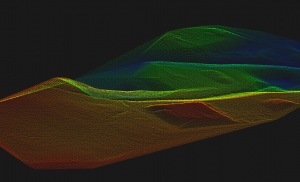
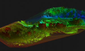
Get highly detailed TIN surface models from dense vegetation in days instead of weeks with drone lidar scanning. We remove the obstacle to high quality data…literally
WORK WITH MODELS IN NATIVE AUTOCAD FORMAT
Use models in software like AutoCad Civil 3D, Infraworks, Rivit, and more. All delivered natively with no conversion necessary.
MAPPING AND MODELING EASIER AND MORE AFFORDABLE THAN EVER
Don’t get caught with out of date information. Easy, repeatable data capture allow maps and models to be updated as often as necessary.
Photogrammetry For Most Jobs
Drone surveying using photogrammetry captures bare earth models, digital surface models, true orthomosaics, and 3D models for deliverables ready for popular CAD or GIS software.
Lidar For More Detail
Lidar captures more detail in most situations especially where heavy vegetation covers key areas. See the ground through wooded areas or create bare earth model that can not be traversed by an other method. Lidar makes light work of hard to survey areas.